 Glastonbury in 1397 is the setting for Joseph of Arimathea’s Treasure, the fifth novel in my Lady Apollonia West Country Mystery Series. Its setting is different from other books in the series in several ways. First, its location in the middle of the Somerset Levels is an unusual geographic location within the West Country of England.
The Somerset Levels is a coastal plain and wetland in the middle of Somerset. Glastonbury is a major town centrally located in the region. From southwest to northeast the Levels are drained largely by the rivers, Parrett, Brue, and Axe. It is the Brue which flows between Glastonbury and its southern neighbour, the town of Street.
The Bristol Channel has some of the highest tides in the world, and the Levels are nearly at sea-level. This means that these wetlands have always been subject to flooding from sea water. Glastonbury is located at the eastern end of a raised peninsula of land which rises hundreds of feet above sea level. Thus, the hill east of Glastonbury could be seen to rise like an island when people approached the town by boat when the area was flooded. The peninsula, surrounded on three sides by the Levels, came to known as the Isle of Avalon which I will discuss in a future posting on the connection of King Arthur with Glastonbury.
Since Roman times, men have reclaimed land by drainage from this wetland as was done in the fens of East Anglia and in Holland. In another future posting, I will discuss the legends about Joseph of Arimathea coming to Glastonbury because these legends say that Joseph lived in this part of England in the early first century before the Romans occupied England and this wetland area. The Bristol Channel at that time probably extended all the way east to Glastonbury. Such access from the sea became rarer as land was drained, especially in medieval times. It was frequently the monasteries such as Glastonbury Abbey that led in this reclamation effort.
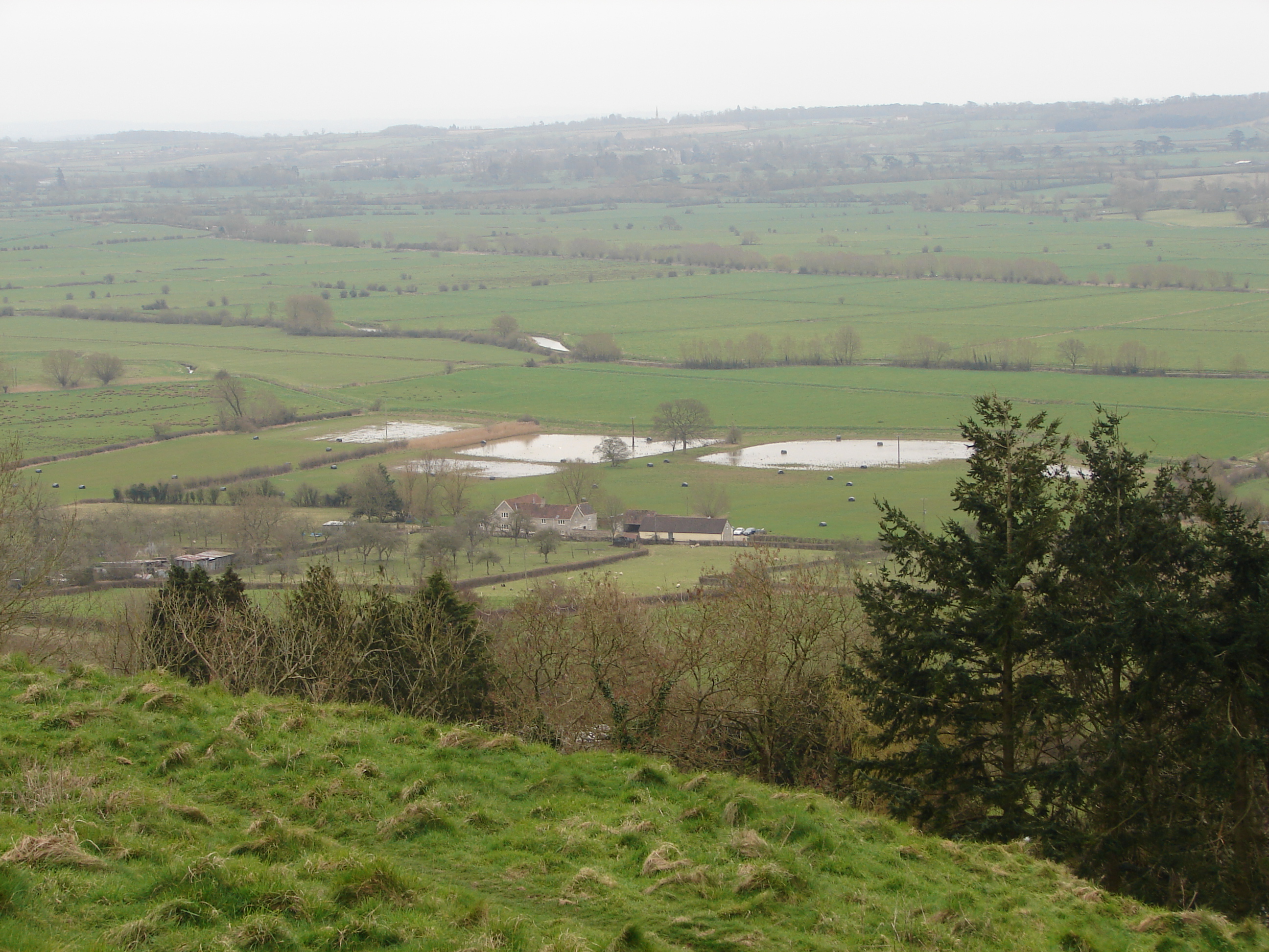
Glastonbury is now more than a dozen miles from the sea, so it is hard for us to imagine access to the town from the sea in the west. Yet, there have been events since medieval times when flooding from the sea again made such access possible. One was in 1607, well after my 14th century story. More recently, in 2013 and 2014, the area was subject to flooding from the sea and from massive rainfalls which caused freshwater flooding. My husband and I experienced some remnants of that flooding on our research trip to Glastonbury in March of 2014. We had to drive an alternate route from north Devon to get to Glastonbury because the direct highway was still closed from the previous winter’s flooding. The picture shown above was taken from the heights of Glastonbury Tor in the direction of the River Brue and shows extensive casual water still in the fields, remaining from serious flooding of the Levels in the winter of 2014.
For more on the Somerset Levels, click on
https://en.wikipedia.org/wiki/Somerset_Levels .
Tags: Chaucer's England, historical fiction, medieval mysteries